
Trail Blazing
Trail Blazing
By Barbara Zirl
I hear a little ping from my phone on a Thursday evening and right away, I’m wondering where we’re hiking Friday morning. It’s becoming a regular thing. I’m actually looking forward to hiking up some mountain trail. I don’t want to give a false impression that this suburban New Jersey girl has suddenly transformed into a California trail-loving Zen master. That’s a long way off. I also can’t say I’d rather exchange a therapeutic a long run listening to music for a walk in the woods. But I have been pushing back some of my phobias to say yes to the trail more often. It’s a break from the monotony of running the same flat creek trail day after day. While I still can’t say I love the dirt, what I do like is the opportunity to spend time with people I miss, even if it means traipsing through single track trails surrounded by poison oak on either side, or trudging up a vertical gravel road in the blazing sun.
We’re still in pandemic lockdown pandemonium and it’s not easing up anytime soon. The paved trails are crowded with too many un-masked pedestrians and irresponsible, oblivious bike riders. If we all wore face coverings, the risk would be 1.5%. On the other hand, the mountain trails are secluded, the trailheads practically hidden from view. So, while large group runs and races are off limits now, meeting up for a run or hike with a few friends in my running social bubble and heading out on a mountain trek is one of the few things keeping me sane.
On Sunday, Memorial Day weekend, Johanne invites me to join her on the Oak Cove trail, which she tells me, is a new area at Calero. I meet her at the parking lot where we did our 25K in February. She knows these trails well, hiking or running on them for years, or riding through them on her beautiful horse. We run on the trail until it’s too steep and then we hike up to the highest point. The payoff is a stunning view of the Calero Reservoir. We chat and laugh and make our way through the wooded scenery for a round trip of 8 miles that takes us a little more than 2 hours.
On a Friday night in mid-June, Victoria and Felicia have decided to hike at Rancho San Vincente the next morning and text me to join them. They tell me the trail is very close me. I look it up and sure enough, it’s minutes from my apartment. Early Saturday morning, we meet up at the dirt trail and tackle the steep hills. The trail is mostly packed dirt and gravel with a few rocky areas. We can still practice responsible social distancing, but it’s much easier on the quiet trails and we can catch up and talk to each other. Our round trip for the hike is 8.32 miles with 863 ft. elevation gain.
Felicia is our trail guide. She wants to explore more trails and she encourages us to install the All Trails App on our phones. I’m too new at this to go run a trail on my own and I’m welcoming the guidance of seasoned trail blazers.
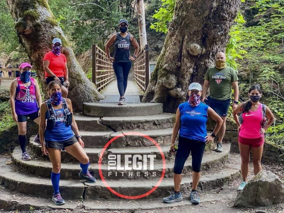
The next Friday, Juneteenth, amid all the racial tensions and daily depressing news, Felicia plans our next hike for the Webb Canyon Trail at Quicksilver. Parul also will join us. So Felcia, Victoria, Parul and I agree to meet early in the morning at the trailhead. I follow my GPS and wind up at a dead end street high up in a neighborhood in Almaden. Fe arrives at the same time I do and realizes the trailhead is around the corner. We find the correct starting point for the trail and start out on the steep hike through narrow trails. We’re following the All Trails app, but the posts with the trail markers are confusing. The arrows point straight up – so you can’t tell which direction you’re supposed to go. We stop at a vista point with a picnic table to look out at the valley and then somehow take a wrong turn and we are lost. We back track following the map on the app and it adds mileage to our hike. Our round trip of 6.62 miles and 940 ft. elevation gain takes 2½ hours.
The next Friday hike at the end of June is set for Quicksilver once again. The four of us meet at Whispering Pines Drive at the McAbee entrance. We take on a shorter 4.82 mile hike with 777 ft. elevation gain and spend the hour and 42 minutes reconnecting and catching up. Later that evening, Victoria texts me with another trail blazing opportunity for Saturday morning with some other Too Legit team members and I say yes…again!
This time, we meet Coach B in South San Jose and follow him in our cars to drive to Alum Rock Park. I’ve never been there. We meet up at the Penitencia Creek Road entrance and find a familiar Too Legit trail running crew ready to explore the popular trail. The plan is to run/hike between 6-8 miles. I learn that Alum Rock, situated between Alum Rock Canyon and the Mt. Diablo foothills, is California’s oldest city park and that at one time it was a health spa with mineral springs, and recreation amenities such as an indoor pool, restaurant, tea garden and a dancing area. It’s returned back to its natural state and today offers running, hiking, biking and horseback riding trails along with picnic areas and occasional wildlife sightings. The Alum Rock veteran trail runners take off running, with Victoria and me at the back of the pack – of course. There are steep climbing sections up into the mountain but the team waits for us to catch up and makes sure we don’t get lost where there are turns. The trail features narrow switchbacks through beautiful vegetation and interesting tree canopies. I’m learning the steps to this trail dance as we pause and flatten against one side of the single track trail to let some bikes pass, perfecting my one-handed move to pull the neck scarf up onto my face when someone closes in from six feet away. Our round trip turns out to be 7.06 miles with 986 ft. elevation gain. It takes us an hour and 46 minutes. Time spent with friends: priceless.
For the 4th of July weekend Friday trail event, Kate, Ginger, Johanne and I plan to meet at Quicksilver Mockingbird entrance and run/hike 7-8 miles. In the morning, we arrive at Gold Creek Way, another unassuming neighborhood trail entrance, just as another group of Too Legit members are getting out of their cars. We all had the same holiday weekend trail running idea. Coach B and the crew of usual speedy suspects pick up their pace right away. We run some of the trail and hike the rest, though we meet up with the team as we all finish about the same time. Our round trip of 7.06 miles took us 2:27 and we covered 1,203 ft. of elevation.
The following Friday, Felicia, Victoria, Parul and I return to Santa Teresa park and meet up early at 5:45 a.m. at a trailhead at Avenida Espana. We take on the very steep hills leading up to the radio tower where I pose with the tower for optical illusion photos. Our relatively short hike of 4.35 miles takes 1:52. We’ve climbed 1,037 ft.
The next day, I’m finishing up my marathon training for the San Francisco Marathon that’s not happening this year (I’ve deferred to next July) and I complete my last long run of 13 miles on Saturday morning on the Los Alamitos Creek Trail. I was actually hoping there might be a hike I could to do on Sunday, when Irina posts an open invitation to join her and Shelly at Limekiln trail. I say yes, but maybe too quickly. When I look up details of the route, it says it’s a 12.9 mile, very difficult trail and now I’m afraid of what I’ve committed to. Sunday morning, I drive a mile up the road from Lexington Reservoir where the Los Gatos Creek trail ends. There I meet Shelly and Irina at the Limekiln trailhead. Shelly is a trail expert and I’m trusting her vast knowledge of this area. The Limekiln trail leads to one called Priest Rock, which I learn is nicknamed “Dogmeat.” It’s all vertical climbing – pure quads, pushing off one leg at a time – and there’s no shade. We’re nearing the crest of the hill and I’m thinking: how are we going to get down? We watch a family on mountain bikes struggle on the downhill terrain. A young teen is glaring at her parents for dragging her up a mountain. The mom is walking her bike. We reach our turnaround point and Shelly leads the way down the trail. I’m tamping down my fear of sliding straight down this gravel road understanding the term “dogmeat” in the pit of my stomach. I’m petrified. I ask Shelly, what’s the secret to getting down this safely? She demonstrates a little confident zigzag. Oh, I see. I interpret this as slalom to slow your speed downhill. Drawing on my old downhill skiing and rollerblading reflexes, I gingerly take a few steps. Side step some, run some. There’s a dicey moment when I can’t control the speed and I’m over striding and slipping. I veer to the side of the trail where there is more gravel and some traction and regain control, my heart pounding. We’ve gone 7.5 miles in about 3 hours and took on 1,984 ft. of elevation gain, my steepest trail adventure this summer.
I’ve gone on all of 14 trail runs or hikes since I got to California nearly two years ago. I put 110.09 miles on my trail shoes so far. That’s a drop in the bucket compared to the more than 50,000 miles I’ve run on the roads in the last 20 years! I’m just kindling when it comes to running in the woods.
The other day, while running back from my usual route on Los Alamitos Creek Trail, I’m covered up to my eyes in a neck gaiter, stifling in the heat, and a lady is heading toward me in her mask, out for a walk. We’re near the one mile marker, near where I saw the mountain lion cubs a few weeks ago. We make eye contact and she asks, looking at the signpost, “does it end somewhere?” Wondering whether there’s a deep existential meaning she’s looking for, I turn off my music and stop my watch. “Oh,” I say, “the trail keeps going to Harry Road. It’s about another 4 miles.” I tell her, “Once you reach Greystone Lane, you can cross the road and keep going. But of course, you can stop and turn around whenever you want! There are no rules.” I laugh. She says, “I mean does it end somewhere, like at a waterfall or something?” “No,” I tell, her, chuckling, “just more of the same trail.” She turns and starts back towards Almaden Lake.
Maybe she should head for the mountains, right?

At Calero Reservoir

Not the hill we climbed at Santa Teresa

At Santa Teresa Park

Radio tower selfie at Santa Teresa

Felicia, me, Victoria and Parul at Quicksilver. Photo credit: Felicia Napoli

Ginger, Kate, me, Johanne at Quicksilver. Photo credit: Bertrand Newson
Alum Rock crew. Photo credit: Bertrand Newson

Irina, me, Shelly at Limekiln. Photo credit: Shelly Reyes

Priest Rock Trail aka Dogmeat!

Lexington Reservoir view from Limekiln

Irina hugging a tree for Maria at Limekiln. Photo credit: Shelly Reyes